[미국] UNH 연구팀, “미래의 빙설, 인프라에 값비싼 결과 초래”
뉴햄프셔대학(UNH) 연구결과 “높은 고도서 눈·비 사이 이동하는 혼합단계 강수량 증가”
심각한 홍수의 주요 원인인 미래의 눈 녹음을 예측하는 것은 더욱 어려워
심각한 홍수의 주요 원인인 미래의 눈 녹음을 예측하는 것은 더욱 어려워
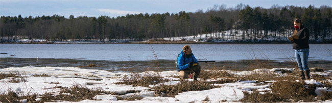
기후변화와 따뜻한 환경이 눈으로 인한 극한 상황을 변화시켰으며, 이전의 연구는 미국 북부와 캐나다에서 눈이 녹는 속도가 점점 더 느려질 것으로 예측했다.
그러나 특히 높은 고도에서 눈과 비 사이를 이동하는 혼합 단계의 강수량이 증가하고 있어 심각한 홍수의 주요 원인인 미래의 눈 녹음을 예측하는 것은 더욱 어렵다.
미국 뉴햄프셔대학(University of New Hampshire ; UNH)의 연구원들은 이전의 연구들을 더 자세히 살펴보았는데, 지리적으로 기후변화에 다르게 반응하기 때문에, 그들은 미래의 눈 녹는 발생이 21세기 후반까지 크게 달라질 수 있다는 것을 발견했다.
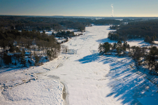
스노멜트(Snowmelt ; 눈 녹음)는 미국 대륙과 남부 캐나다에서는 감소할 수 있지만 알래스카와 북부 캐나다에서는 증가하여 더 큰 홍수 취약점이 발생할 수 있으며 비용이 많이 드는 기반 시설 파괴를 포함한 주요 사회 및 경제적 결과를 초래할 수 있다.
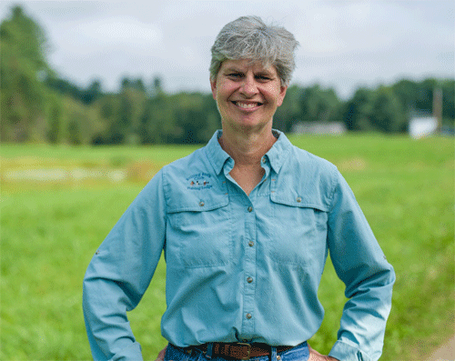
뉴햄프셔대학의 제니퍼 제이콥스(Jennifer Jacobs) 토목환경공학과 교수는 “미래 홍수 추정은 까다로운 일이 될 수 있지만 미래 인프라를 계획하는 사람들에게는 중요한 정보”라면서 “예를 들어, 겨울 동안 주로 홍수가 발생하는 지역이 있다면, 이 작업은 미래의 상황을 처리할 수 있는 인프라를 구축하는 데 큰 도움이 될 것이다. 또한 홍수가 감소한다면 설계값도 초과 설계보다는 감소해야 한다”라고 말했다.
최근 『지구물리학 연구소식 저널(journal Geophysical Research Letters)』에 발표된 이 연구는 눈 덮인 들판(snowpack), 스노멜트(Snowmelt) 및 유출수의 변화에 대한 이전 연구 예측을 조사하여 수자원 관리자 및 엔지니어링 설계자, 북부 캘리포니아, 태평양 북서부, 알래스카 및 캐나다 지역에 거주하는 일반 대중에게 도움이 되는 정보로 번역하는 것을 목표로 했다. 연구원들은 북아메리카에 초점을 맞춘 역사적 지도와 지역 기후 모델(RCM) 시뮬레이션을 사용했다.
연구원들은 미국 북부 캘리포니아와 태평양 북서부 같은 서해안 산간 지역은 따뜻하고 더 많은 비가 내릴 것으로 예측되기 때문에 눈 위에 비가 내릴 위험이 더 클 수 있다는 것을 발견했다. 이는 기존의 눈덩이가 녹는 것을 증가시킬 수 있고 유출 잠재력이 커져 홍수 위험이 증가할 수 있다.
그러나 이것은 알래스카와 캐나다 북부 같은 극도의 추운 지역에서 달랐다. 연구원들은 이 지역의 따뜻한 기온이 눈과 같은 겨울 강수량을 증가시킬 수 있는 습기의 기회를 증가시킬 수 있다는 것을 발견했다.
“이러한 발견은 기후 적응을 위한 연방과 주 정부의 장기적인 정책을 개발하거나 수정하는 데 도움이 될 수 있다”라고 뉴햄프셔 대학의 박사 과정 학생이었던 조은상(Jo eun sang) NASA의 고다드 우주 비행 센터(Goddard Space Flight Center)의 박사후 연구원이자 이 연구의 수석 저자는 말했다.
그는 “예를 들어 현재 미국 정부의 물 관련 인프라 설계 표준은 눈 또는 눈 녹은 정보에 대한 지침이 매우 제한적인 액체 강수 데이터를 기반으로 한다”라고 강조했다.
연구자들은 댐의 잔존화와 같은 특정 기반시설 정책은 극한 기후 조건에 대한 정보에 의존한다고 지적한다. 이 정보는 엔지니어가 과거의 조건을 기반으로 하지 않고 미래의 조건을 예측하는 인프라를 설계하는 데 도움이 될 수 있다.
그들의 이전 연구에서 제니퍼 제이콥스(Jennifer Jacobs) 교수와 조은상(Jo eun sang) 연구원은 미국 대륙 전체의 눈 녹음을 설명하는 지도를 만들었다. 그들은 이 정보가 캘리포니아 주에 의해 그들의 유물 발굴 과정에서 이미 사용되고 있다고 말한다.
이 연구는 NASA의 응용과학 수자원 프로그램과 미국 에너지부의 생물학 및 환경 연구 프로그램의 자금 지원을 받았다.
뉴햄프셔대학(University of New Hampshire)은 뉴햄프셔 주, 국가 및 세계의 삶을 혁신하고 변화시킨다. 미국 50개 주와 71개 국가에서 온 1만6천 명 이상의 학생들이 200개 이상의 연구 프로그램에 걸쳐 경영, 공학, 법률, 보건 및 인적 서비스, 문과 및 과학 분야에서 최고 수준의 프로그램에 참여하고 있다.
카네기 분류(Carnegie Classification) R1 기관인 뉴햄프셔대학은 NASA(미국 우주항공국), NOAA(국립해양대기청), NSF(국제원자력기구 핵안보기금 ; National Science Foundation) 및 NIH(미국 국립보건원 ; National Institutes of Health)와 파트너십을 맺고, 21 회계연도에 육지, 바다, 우주의 경계를 더 탐사하고 정의하기 위해 2억 6천만 달러의 경쟁적 외부 자금을 지원받았다.
[원문보기]
UNH Research Finds Future Snowmelt Could Have Costly Consequences on Infrastructure
DURHAM, N.H.- Climate change and warmer conditions have altered snow-driven extremes and previous studies predict less and slower snowmelt in the northern United States and Canada.
However, mixed-phase precipitation?shifting between snow and rain?is increasing, especially in higher elevations, making it more challenging to predict future snowmelt, a dominant driver of severe flooding.
Researchers at the University of New Hampshire took a closer look at previous studies, and because geographical areas respond differently to climate change, they found future snowmelt incidences could vary greatly by the late 21st century.
Snowmelt could decrease over the continental U.S. and southern Canada but increase in Alaska and northern Canada resulting in larger flooding vulnerabilities and possibly causing major societal and economic consequences including costly infrastructure failures.
“Estimation of future floods can be a tricky business and yet it is important information for those planning future infrastructure,” said Jennifer Jacobs, professor of civil and environmental engineering. “For instance, if a region primarily has floods occurring during the winter, then this work could really help build infrastructure that can handle those future conditions. And, if the floods are decreasing, then the design values should also decrease rather than over design.”
Their study, recently published in the journal Geophysical Research Letters, looked at previous study predictions of change in snowpack, snowmelt and runoff with the goal of translating it into information that would be helpful for water resources managers, engineering designers and the general public living in the areas of Northern California, Pacific Northwest, Alaska and Canada. The researchers used historical maps and regional climate model (RCM) simulations that focused on North America.
They found that in the West Coast mountain areas, such as Northern California and the Pacific Northwest, there could be greater risk of rain-on-snow flooding because these areas are predicted to warm and produce more rain. This could increase the melting of any existing snowpack and lead to larger runoff potential, increasing flooding risk.
But this differed in extreme cold regions like Alaska and northern Canada. Researchers found warmer temperatures in these areas could increase the opportunity for moisture that could likely lead to more winter precipitation like snow.
“These findings can be important in helping to develop or modify federal and state governments’ long-term policies for climate adaptation,” said Eunsang Cho, a former UNH doctoral student, now postdoctoral researcher at NASA’s Goddard Space Flight Center, and lead author of the study.
“For example, the current U.S. government standards for water-related infrastructure design are based on liquid precipitation data with very limited guidance on snow or snowmelt information.”
The researchers point out that certain infrastructure policies, like the relicensing of dams, depend on information about extreme weather conditions. This information can help engineers design infrastructure not based on past conditions but to anticipate future conditions.
In their previous research, Jacobs and Cho created a map that accounts for snowmelt across the continental U.S. They say this information is already being used by the state of California in their relicensing process.
This research was funded by NASA’s Applied Sciences Water Resources Program and the U.S. Department of Energy’s Office of Biological and Environmental Research program.
The University of New Hampshire inspires innovation and transforms lives in our state, nation and world. More than 16,000 students from all 50 states and 71 countries engage with an award-winning faculty in top-ranked programs in business, engineering, law, health and human services, liberal arts and the sciences across more than 200 programs of study.
A Carnegie Classification R1 institution, UNH partners with NASA, NOAA, NSF and NIH, and received $260 million in competitive external funding in FY21 to further explore and define the frontiers of land, sea and space.
[출처=뉴햄프셔대학(UNH Research Finds Future Snowmelt Could Have Costly Consequences on Infrastructure | UNH Today) / 2021년 12월 7일자 보도자료]